Rehoboth (Rehoboth)
Rehoboth is a town in central Namibia just north of the Tropic of Capricorn. Located 90 kilometres (55 miles) south of the Namibian capital Windhoek, Rehoboth lies on a high elevation plateau with several natural hot-water springs. It receives sparse mean annual rainfall of 240 mm, although in the 2010/2011 rainy season a record 731 mm were measured. In 2005, it had a population of 21,378 later increased to 28,843 in 2011, according to the 2011 Namibian Population and Housing Census.
Rehoboth is intersected from north to south by the national road B1, which also serves as the border of the two electoral constituencies in the town, Rehoboth Urban West and Rehoboth Urban East. Rehoboth is the core territory of the Baster community which still lives according to their Paternal Laws which were enacted in 1872.
Rehoboth is divided into eight neighbourhoods, called blocks. The oldest part of the town is blocks A, B and C, of which block B contains most public services and shops. Block D is home to the wealthiest inhabitants of the town. Block E is the poorest neighbourhood and was originally (under Apartheid) designated for blacks. Blocks F, G and H are the newest neighbourhoods. The current mayor of the town is Mr. Pieters, living in Block E.
Public amenities include a public hospital, primary and secondary schools and a district court with resident magistrate. The Oanob Dam, approximately six kilometres (4 miles) from Rehoboth, supplies the town with fresh water. The majority of the population consists of Basters.
Map - Rehoboth (Rehoboth)
Map
Country - Namibia
 |
 |
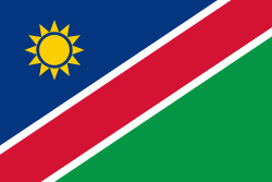
| Flag of Namibia | |
The driest country in sub-Saharan Africa, Namibia has been inhabited since pre-historic times by the San, Damara and Nama people. Around the 14th century, immigrating Bantu peoples arrived as part of the Bantu expansion. Since then, the Bantu groups, the largest being the Ovambo, have dominated the population of the country; since the late 19th century, they have constituted a majority. Today Namibia is one of the least densely populated countries in the world.
Currency / Language
| ISO | Currency | Symbol | Significant figures |
|---|---|---|---|
| NAD | Namibian dollar | $ | 2 |
| ZAR | South African rand | Rs | 2 |
| ISO | Language |
|---|---|
| AF | Afrikaans language |
| EN | English language |
| DE | German language |
| HZ | Herero language |


